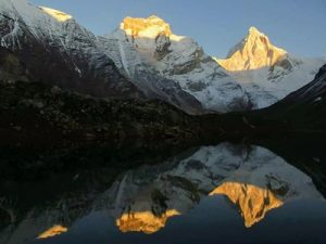
Uttarakhand
Pindari Glacier Trek
18-May-2025
- Duration
- 8 Days
- Max Altitude
- 3750 m
- Trail
- 70 km
- From
- ₹19,500
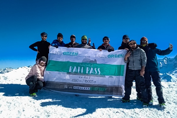
Upcoming summer Bali pass trek starting on 30st May 2026 from Dehradun (Maximum group size 10 persons).
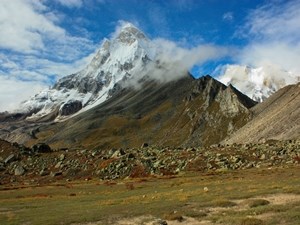
Lesser known Bali Pass trek is the trail to cross the watershed between Yamuna and its main tributary Tons river. Bali pass at ~ 16000 ft connects the Ruinsara – Har Ki Dun area with Yamunotri valley. This one is a moderate yet a next level trek. If you have already been to moderate treks like Roopkund, Rupin Pass or Goecha La then this is the next step forward. Bali Pass trek route is a relatively shorter duration trek which requires walking of less than 60 Km trail. Although the pass itself at ~ 16000 ft offers the variety of elements and associated challenges.
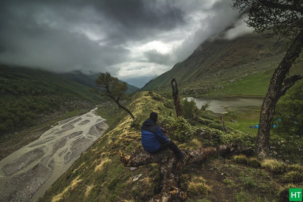
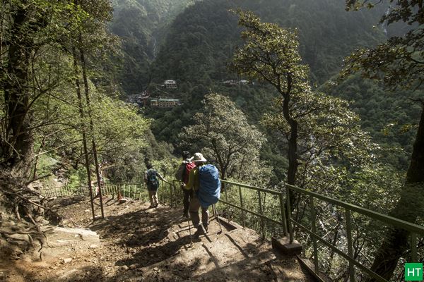
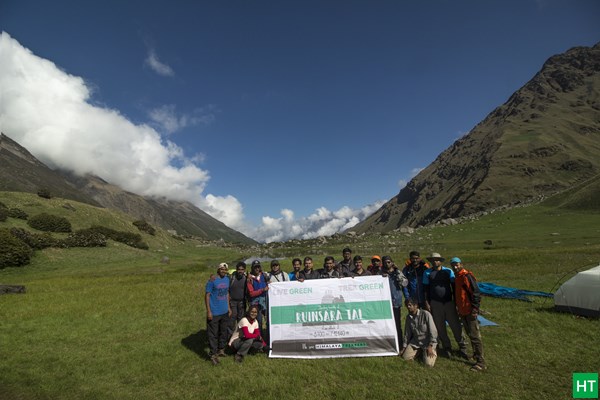
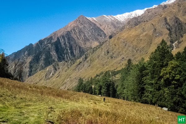
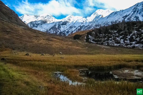
The trek can be split into two portions. Initially the lovely and gentle walk along the river valley to a beautiful shallow lake called Ruinsara Tal at the base of Mt. Swargarohini. Initially from Taluka you will follow traditional route to Har Ki Dun up to Seema, following Tamosa/Har Ki Dun nala. The we keep going along the valley to enter into Ruinsara Nala gorge and valley.
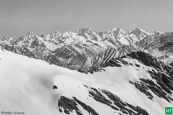
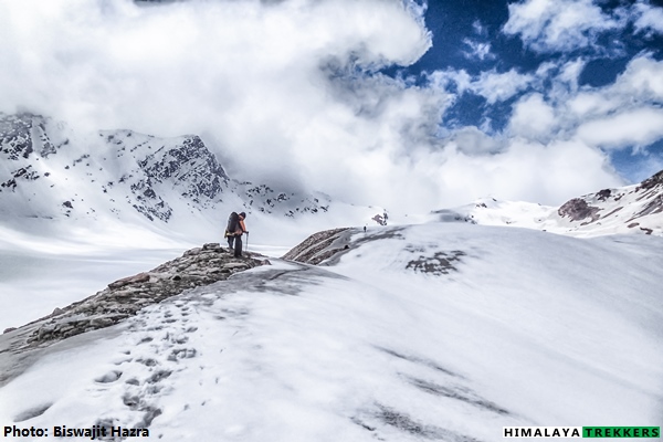
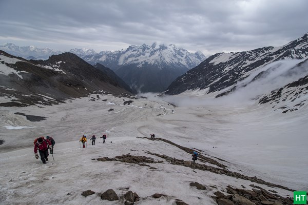
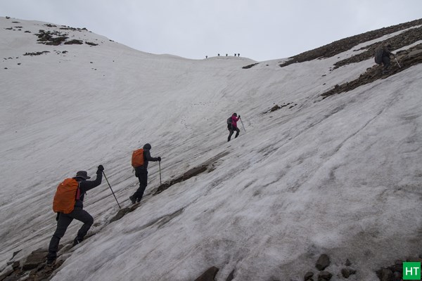
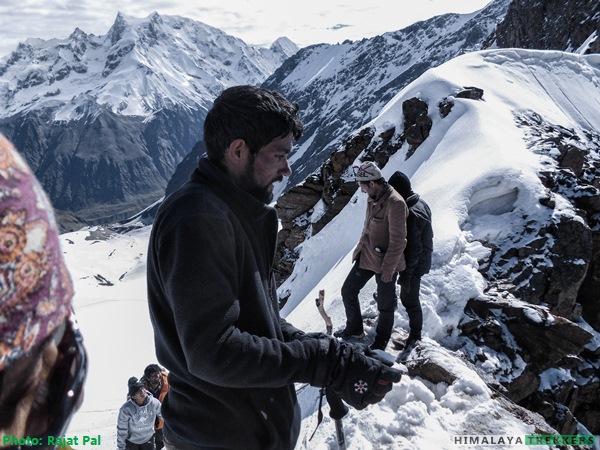
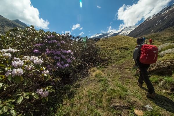
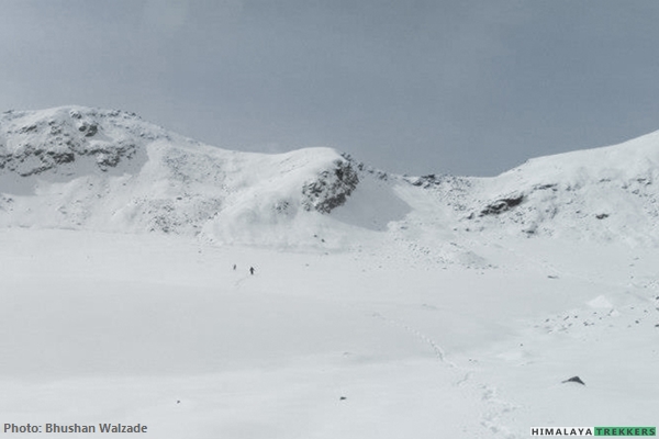
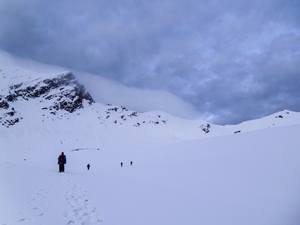
Trail ahead of Odari produces the challenge and experience of walking on moraine ridge and boulder, and finally on the glacier to the snow/ice bound Bali pass. We will set up the base camp on moraine/snow before the final push to the pass. Last stretch to the pass is quite steep and can be pretty tiring. The views from the pass include magnificent views of Swargarohini group of peaks, Bandarpunch, Kalanag (Black peak) and the host of peaks to the east of Gangotri valleys.
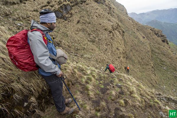
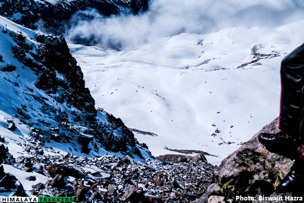
The descent from the pass is tricky and you need to negotiate either steep rock section on snow or taking the sharp ridge and traverse instead. Overcoming the descent from the pass, you have to cross a boulder region and then you are on meadows of upper Dhamni area. Surprise doesn’t stop here as the meadows finish abruptly and then you have to carefully handle the steep grass slope to finally into treeline. At the end of the trek you reach Yamunotri. In a nutshell during this trail we follow the main tributary of Yamuna, the Tons river to it’s origin and then descent following the main Yamuna river.
From the below graph you will get an idea of the gradient of the trail and a rough pictorial distances between important points of the trek.
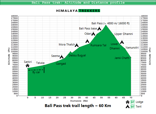
Bali Pass trek has shorter trail length around 60 Km and hence of shorter duration comparing to the “Difficult” grade treks that we classify as. It doesn’t require sustained walking on moraine debris or glacier or challenge of acclimatisation difficulties.
In spite of not being a Difficult trek, this should not be compared with popular “Moderate” grade treks like Roopkund, Rupin Pass, Hampta Pass or Goecha La. To begin with, this is not a popular route, so trails are not maintained at places. Due to monsoon and other natural erosion trail may produce unexpected bumps and need careful negotiation.
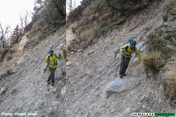
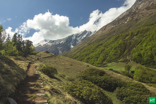
After Ruinsara Tal we take the ridge towards Bali Pass. Depending upon season and snowfall we will encounter snow after Odari camp. After Odari we will encounter median moraine of the glacier coming down from the top. The final ascent to the pass is steep and the descent is steeper on rock and snow/ice. Literally you may have to climb down from the pass.
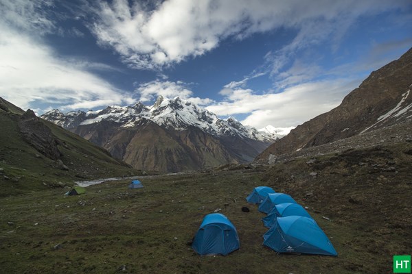
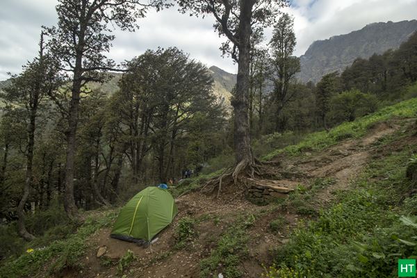
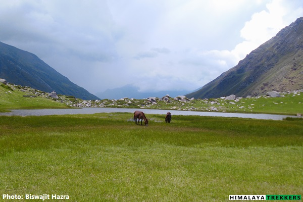
As per Uttarakhand High Court order ( Petition No. : 123/2014 ) , one can not camp on alpine and sub-alpine meadows/grasslands, locally called “Bugyal. Following this order Forest department has revoked the permission of camping at Ruinsara area starting from September 2018. We will camp at Unti gad inside treeline by noon which is 2 Km before Ruinsara. After lunch we will visit Ruinsara Tal, explore the fascinating valley around, and finally return to Unti Gad camp.
Like all high altitude treks in Uttarakhand, you have two seasons/windows for Bali pass trek.
Each season has its pros and cons. Here we will see how the landscape changes and weather differs from one season to another.
More greenery in May/June while contrasting foliage in Sep/Oct:
During summer forest and meadows turn greener and flowers bloom. From September fall colours appear, trees and grasses turn in to yellow, orange and brown. Both are a delight for your eyes.
Snow conditions in summer and fall:
As the summer progresses deposited snow and glacier melts. You will get more frosty snow and ice during May/June. September remains least snowy and from October chance of fresh snowfall increases.
During summer day time temperature will be warmer where as after monsoon the temperature will start lowering. Around Ruinsara and ahead temperature will become significantly cold in October.
Now you have the understanding of each season and their differences. Give us a call in case you are not sure about which season to choose.
Pre monsoon/Summer (May/June): Day time weather remains warm, specially if it is sunny and scorching and can go as high as 25/30°C. Night/early morning temp at Bali Pass base can be around 0°C to 5°C.
Post monsoon/Fall (Sep/Oct): From October temperature starts cooling down. At Ruinsara lake temperature can plummet to freezing in the night/early morning. Be prepared for 0°C or lower on the highers camps.
a) A base layer, can be a thermal layer or a quick dry t-shirt.
b) A heavy jacket (Double layer or Fleece jacket ) as middle layer.
c) A windproof with hood as the outer layer.
We will arrange a pickup from Dehradun railway station to Sankri and back to Dehradun. This will be shared by the team members on actual basis and paid directly to the driver. The fare is ₹ 6500 for a Tata Sumo from Dehradun to Sankri. This can accommodate 6 to 8 people. Similarly it is approximately ₹ 8000 from Janki Chatti to Dehradun back. . This is NOT included in TREK FEE.
To reach the trek base Sankri independently/public transportation check the details in GETTING THERE TAB.
| Expertise: | 10 years on ground experience |
|---|---|
| Support staff: | Qualified local & office staff |
| Group size: | Small groups up to 15 |
| Insurance: | Travel insured trek and tour itinerary |
| Easy Bookings: | 25% Booking Deposit |
Duration: 7 days of trek; Walking from Taluka to Ruinsara Tal, crossing Bali Pass and descend to Yamunotri; Dehradun to Dehradun in 8 days.
Prerequisite: Prior high altitude Himalayan trekking experience(s) is a must (around ~ 4500 m/ 13760 ft). Should have good physical fitness.
Grade: Moderate with a tricky pass to negotiate
Physicality: 7.5/10
Trail Length: 58 Km
Highest Point: Bali Pass ~ 4880 m/16005 ft
Seasons: March to June and September to December.
Further Option: Continue to further north and cross Borasu Pass to reach Chitkul on Baspa valley in Kinnaur. (Difficult grade trek). Explore Jaundhar glacier (2 days side trip)
Access: Trek starting point and end point is Sankri.
Rail station: Dehradun (STN Code: DDN)
Airport: Delhi; Jolly Grant in Dehradun (Airport Code: DED)
Map:
| DEPARTURE LOCATION | Dehradun railway station |
| REPORTING TIME | 7:00 AM for a prompt departure to Sankri (Day 1) |
| RETURN LOCATION | Dehradun |
| RETURN TIME | Approximately 9:00 PM (Day 8) |
Nearest Rail station: Dehradun (Station Code: DDN)
Nearest Airport: Delhi, Jolly Grant in Dehradun (Airport Code: DED)
Based upon your request we will arrange a pick up and drop from Dehradun to Sankri and back. This will be shared equally by the team members on actual basis. You pay directly to the driver/transporter. The fare is Rs 5500 for a Tata Sumo/Mahindra Maxx one way. This can accommodate 6 to 8 people. A Tempo Traveller charges Rs 9000 (12-14 seat) one way. This is NOT included in TREK FEE and to be paid directly to the driver/owner.
If you wish to reach our Trek Base Sankri on your own by public transportation:
For the treks at Uttarkashi district in Garhwal , one has to reach the capital city of Uttarakhand, Dehradun, specially the trek starting from Sankri, Yamunotri etc. Haridwar, Rishikesh and Dehradun are 3 nearby cities in the area and one can move from one to another by public vehicles like bus or shared Jeeps.
For more options to reach Haridwar you can check here.
Haridwar to Dehradun: 55 Km and may take one and half to 2 hours.
Dehradun to Rishikesh: 45 Km and may take around one and a half hour.
You can fly or by train reach New Delhi as per your convenience from any part within India.
There are direct trains from Kolkata to Dehradun.
KUMBHA EXPRESS – Train No. – 12369 ( Very good option to reach Haridwar by 5 pm; You can take a bus from the terminus just opposite to the railway station referred as Roadways bus stand/ISBT and reach Dehradun in one and half hour. Spend the night in Dehradun and start your onward journey by car next morning.)
UPASANA EXPRESS – Train No. – 12327 ( Very good option to reach Dehradun directly by 5 pm; Spend the night in Haridwar and start your onward journey by car next morning)
DOON EXPRESS – Train No. – 13009 (Don’t book this train when you plan a long onward journey immediately in the morning)]
Avoid booking wait listed (WL) tickets in AC classes (1A/2A/3A) or Chair Car (CC). Book Sleeper class (SL)/Second Sitting class (2S) tickets which have normally more seats/berths and hence much better chance to get confirmed.
Following trains are good to reach Haridwar and run daily.
DDN JANSHTBDI – Train No. 12055 (Arrives DDN in the evening @ 9:10 pm, good choice when you stay the night in Dehradun and have a long drive ahead next day)
NANDA DEVI EXP – Train No. 12205 (arrives DDN early morning @ 5:40 am)
Always avoid booking waitlisted (WL) tickets in AC classes (1A/2A/3A) or Chair Car (CC). Book Sleeper class (SL)/Second Sitting class (2S) tickets which have normally more seats/berth and hence much better chance to get confirmed.
Govt. Road Transport (Roadways of Uttarakhand, Uttar Pradesh, Delhi, Haryana, Punjab etc.) buses are frequently available in day time and night from Kashmiri Gate ISBT (http://www.delhi.gov.in/wps/wcm/connect/doit_transport/Transport/Home/ISBT/Fare+Chart). Tickets are available on board for these regular type buses. From Delhi Airport or Station you can reach ISBT Kashmiri Gate via Delhi Metro service (http://www.delhimetrorail.com/metro-fares.aspx). It is only 4 Km from NDLS and can be reached easily by booking an auto rickshaw.
For privately operated bus, you can book online from different portals. Select a boarding point suitably. Overnight Volvo/A.C/Push back buses are available. Normally these buses take up to 7 hours to reach Dehradun ISBT. You can book an auto rickshaw for Railway Station (5 Km away)/Hotel Drona (GMVN) or take a shared auto (Route No. 5) from ISBT.
[There are two major bus terminus in Dehradun. The buses from Delhi/Haridwar goes to the ISBT (Inter State Bus Terminus) and the other one is the Parvatiya Depot (Hill Depot, from where you can get the buses going up the hills like Uttarkashi, Barkot, Purola etc) located just beside the Railway station.
Nearest Airport Jolly Grant is 25 Km away from Dehradun. book a private taxi to reach Dehradun city. This airport is accessed from Dehradun, Haridwar and Rishikesh easily. The flights are mostly via Delhi.
For night stay in Dehradun:
Trekkers reaching on the previous day before the journey to the actual trek base need to stay the night in Dehradun. There are several options in Dehradun for spending a night while staying in Premium, Standard or Budget accommodation. Options vary from Privately operated Hotels/Lodges, to state run Tourist Rest Houses.
State run GMVN (Garhwal Mandal Vikas Nigam) operates Hotel Drona complex is 10 minutes walking from the railway Station. You can book an auto rickshaw. From ISBT it is around 5 Km. You can book an auto rickshaw to Hotel Drona (GMVN) or take a shared auto (Route No. 5) from ISBT (Inter State Bus Terminus). This is a reliable and a decent choice for Standard accommodation. The have restaurant and room service.
Check the following for online booking of the above: http://www.gmvnl.com/newgmvn/tour/booktrh.asp
You can call or visit GMVN nearest office or even send an email for more information.The information is available at:
http://www.gmvnl.com/newgmvn/online_reservation/#
Normally you reach Dehradun from any trek base by 6/7 pm in the evening. You can take any train after 9 pm or regular bus service as mentioned above to reach Delhi or directly to your homeward journey in the same night.
Inclusions:
1 night’s accommodation at Sankri (Day 1 ) in lodge on twin/triple sharing basis and dinner.
Car drop from Sankri to Taluka on Day 2.
All meals during the trek (starting from Day 1 dinner and ending on Day 8 breakfast). Regular Indian style nutritious vegetarian food during the trek (including occasional eggs), breakfast packed/hot lunch (depending upon the time you reach a campsite), snacks, dinner along with coffee/tea/soup.
Excellent Trekking Guide, who will be a local to this particular area and has profound knowledge of the trekking trails around.
Specialised Cook, Support staff, Porters for carrying the central logistics of the trek.
Stay in tents on a twin sharing basis. We will provide separate tents for men and women.
Camping equipment like Sleeping bag, Carry mattress, Gaiters, Micro spikes. (Bring your own sleeping if you have a high altitude specific personal Sleeping Bag. This is always better for hygienic reasons.)
Kitchen tent, dinning tent and toilet tent as required during the trek.
All permit fee, camping charges, forest levy required for the trek.
Basic Medical & First Aid kit.
Travel insurance cum Accidental Insurance Policy covering high altitude trekking tours (For Indian nationals it is included in the TREK FEE, up to 60 years of age). It covers your trek as well as your itinerary for a maximum duration of 10 days.
Exclusions:
Transportation from Dehradun to and back (Approximately ₹ 3000 per person including pick up and drop when shared with fellow trekkers)
We assume that you will carry your personal Rucksack/Backpack with all your personal belongings. If you want to offload your Rucksack and be carried by our Pack Animal/Porter then you need to pay additional ₹ 5000 + 5% GST for the entire duration of the trek. The Rucksack should weigh within 10 kg.
Single Occupancy Tent @ ₹ 5000 + 5% GST for the camping days.
₹ 5000 + 5% GST per person additional charge for foreigners towards various permits and levies inside National Park.
Any tip or gratuity to the HT supports staff.
Anything that is NOT mentioned in the “Inclusions” or personal in nature.
Day 1
Drive to Sankri: 200 Km - 10/11 hours
Pickup in the morning from Dehradun and reach Sankri (~ 1900 m, 6230 ft) . Distance around 200 Km and can take 9/10 hou rs. The road is one of the most scenic in Garhwal region while we go up to the classy hill station of Mussorie at the beginning, turquoise Yamuna river in the middle and conifer forests of blue pine and meandering Tons river at the later half of the journey. The major points are Mussorie, Yamuna Pool, Damta, Nawgaon, Purola, Mori and Netwar. Mori is the last place from where one can get a confirmed mobile phone network and also has a SBI ATM. Though Sankri has a BSNL tower but network doesn’t remain most of the time! After crossing Netwar we reach the check post of Govind Vanya Jibh Vihar (Govind National Park) from where the permits need to be obtained. Sankri has few private lodges and a GMVN operated Tourist Rest House (TRH) and couple of basic restaurant to serve food. Night stay in lodge/homestay.
Day 2
Drive to Taluka: 1 hour; Trek to Seema: 14 Km - 6/7 hours
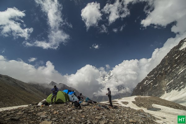
Wake up early in the morning to see the first sun light on Sankri. It is a small stretch of Bazaar and the adjacent village. After breakfast we prepare to start our trek. There is a motor able Kaccha road from Sankri to Taluka heading up the valley. The bumpy 11 Km ride takes around 45 minutes to reach Taluka (~2100m, 6900ft). Our walk starts from Taluka. The camping ground is adjacent to the Forest Rest House. There is a small tea shop at the end of the road and 2/3 very small provision stores. We directly take the stony stair cases to get down almost to the river bed and start walking along the Tamosa river, keeping it on our left (“True Left” of the river). It is an easy gently walk gradually moving up the valley. Snow is encountered at patches where sun doesn’t get a chance to enter for longer duration. After walking for an hour we cross a side stream and move on to an flat opening on the left hand of the trail. Local people are seen in an interval with heavy loads on their back aiming to stock provisions for long winters. There are few villages in this valley like Datmir, Gangar, Powani and Osla, the last one being the farthest. Walking along the valley in the shades of conifer and occasional snow patches for 9 Km, we reach a side stream and cross the bridge to get on the main valley again. This place has also a bridge on the Tamosa river and the Village named “Gangar” is mostly on the other side of the river. From here we continue our gradual walk for another hour to reach an opening with a new concrete construction for a proposed school. A bridge on Tamosa is built here to reach the village of Osla. We keep our track while the river is on our left and walk another hour inside a sun shed thick forest to reach Seema (~2500m, 8200ft). The last stretch remains snowy in winter and avoid slush. One GMVN TRH and a Forest Rest House along with a solitary private Dhaba (Opens from Jun till Oct) to serve food. Prior booking of the any of these is highly recommended for trekkers who don’t have camping setup. Camping ground is also nearby. Seema is not a village but only a tourist shelter point. The village Osla is on the other side of the river, almost ~ 215 m/700 ft above the river bed. Total distance is 14 Km and may take 6/7 hours. We camp for the night.
Day 3
Trek to Mora Thatch: 10 Km - 5/6 hours
Day 4
Trek to Ruinsara Tal: 7 Km - 3/4 hours
Day 5
Trek to Odari: 4 Km - 3/4 hours
Day 6
Trek to Bali Pass base: 3 Km - 3 hours
Day 7
Cross Bali Pass and descend to lower Dhamni: 12 Km - 7/8 hours
Day 8
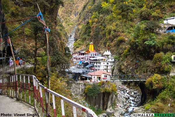
Trek to Yamunotri and then to Janki Chatti: 8 Km - 3/4 hours
P.S.: Distances and altitudes are approximate and may not be exact.
If you need more clarifications write in to [email protected]
Uttarakhand
18-May-2025
Uttarakhand
Kedartal: A short high alpine trek from Gangotri We run the Kedartal trek as limited seasonal group departures (check availability) or as…
Uttarakhand
Uttarakhand (May,Jun,Sep,Oct)
Tour Reviews
We organised a bit last minute our trek to Uttarakhand. WE were well informed, given maps,advice,recommandations, HT helped us within our criterias,budget and brief to compose a beautiful trek for the late Season. WE lived a wonderful expérience, with kind,attentionate guides, porters,muleteer,Cook. WE crossed breathtaking fall landscapes. Had Amazing food. Everything was absolutely well and professionnaly organised.
Leave a Review