Uttarakhand
Kalindi Khal Trek
Kalindi Khal Trek: If you are an avid trekker on Indian Himalayas and hanging around for some time, Kalindi Khal trek (same…
- Duration
- 16 Days
- Max Altitude
- 5945 m
- Trail
- 100 km
- From
- ₹95,000
Upcoming Panpatia Trek starting from 1st June 2024.
Panpatia Col trek route (also referred to as Panpatia Pass) is the shortest possible approach from Badrinath to Kedarnath over high glaciers and passes. Essentially this area (or more specifically the col) is the watershed between Badri and Kedar region i.e. Alaknanda and Mandakini river system.
In curiosity legendary mountaineers Eric Shipton and Bill Tilman ventured back in 1934 to find out the truth. The arduous journey required mountaineering skills and concluded that it is impossible to perform rituals and Puja by the same priest at Kedar and Badri on same day.
In reality, this trail unfurls raw beauty of core Himalayas on the heartland of central Garhwal. It takes you to the very base of Chaukhamba pillars and walk parallel on the Panpatia glacier (a.k.a snow/ice fields).
Panpatia Col at 5200 m/17056 ft (Location: 30.670735° N, 79.314648° E) is a narrow passage on the south-west corner of the Panpatia glacier that one can get down to Mad(hya)maheswar/Kedarnath valley side, starting from Badrinath side.
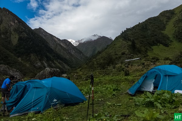
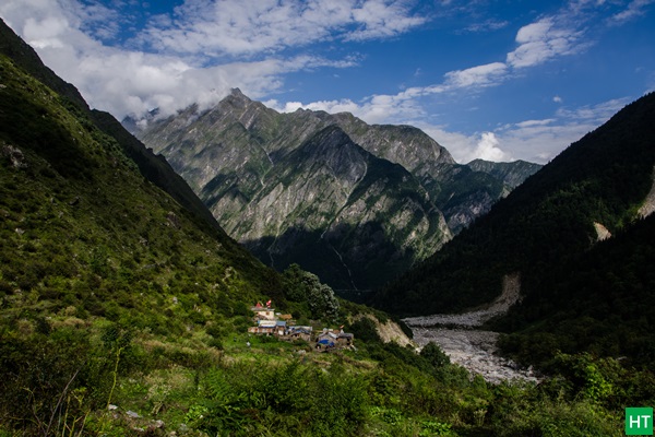
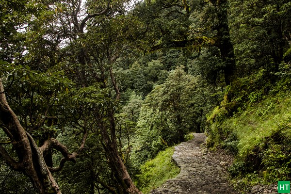
We leave main Alaknanda river valley, some 30 Km ahead of Joshimath towards Badrinath and get into the side valley to the left (true right of Alaknanda). Initially we will cross lush green forest and the only village this side called Khirao. From here we will climb a ridge and then traverse a jungle to finally reach the meadows. We camp last time around tree line here at Shepherd’s campsite until Madmaheshwar.
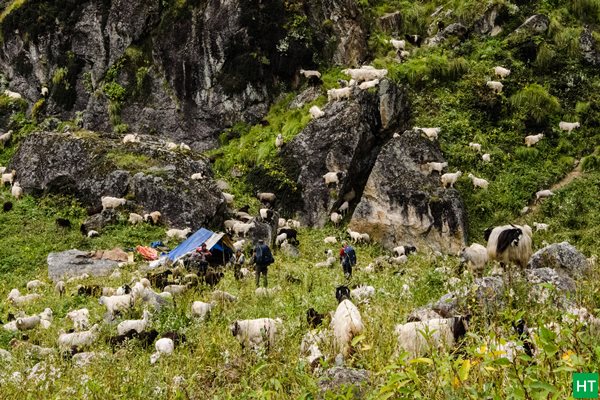
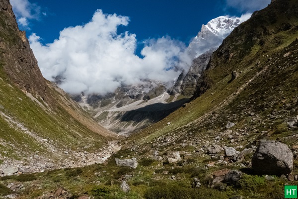
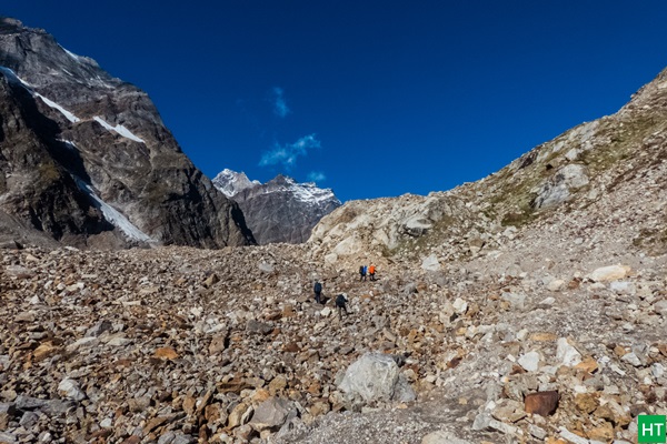
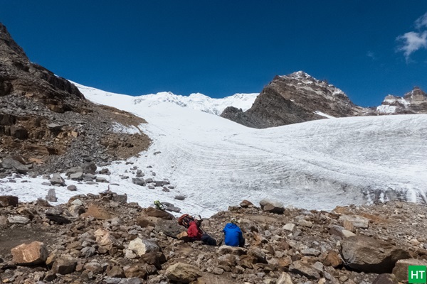
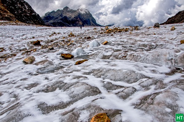
Within couple of hours leaving from Shepherd’s camp you will enter boulder and moraine zone following the main valley towards left. From here long walk and hop on glacial moraine will continue almost till we reach Panpatia glacier. In post monsoon (late Aug to late Sep) this stretch is tiring due to frequent ups and downs. At the head of this valley you can locate a glacier, sometimes referred lower Panpatia ice field. We will cross this glacier to continue on right and climb a very steep ridge along a stream to camp below Parvati Gully/Rock.
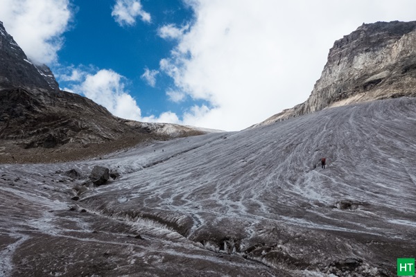
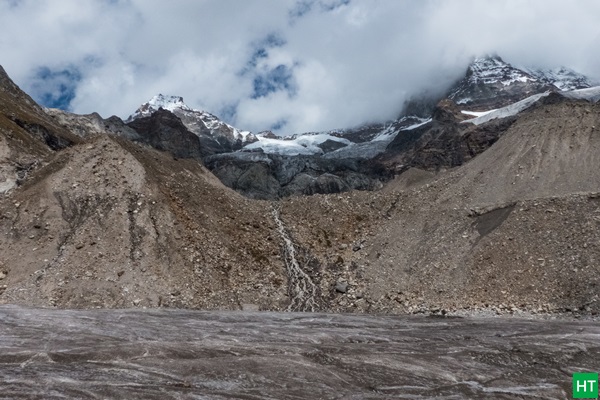
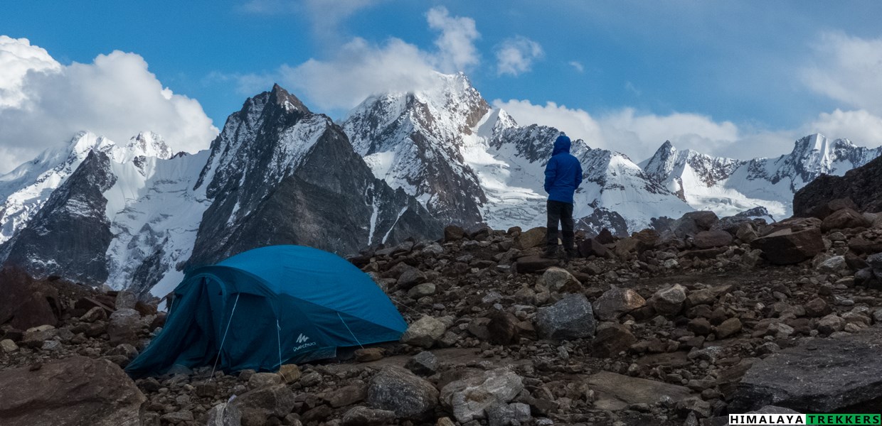
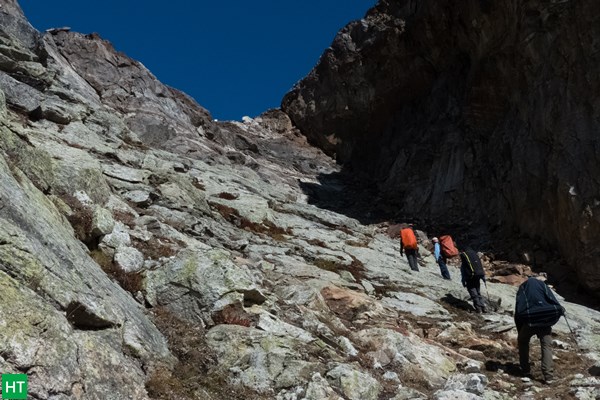
After camping at the Parvati rock base, we climb the rocky Parvati Gully. To negotiate at stretches you may need to scramble, if needed. Due to snow in summer, we may need to fix rope here. Finally traversing the rocky gully we get in to base of Parvati peak. Panpatia glacier or the upper ice field starts from here.
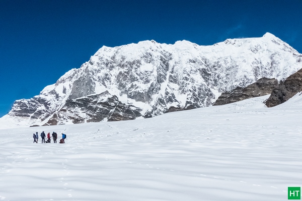
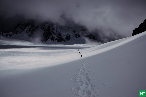
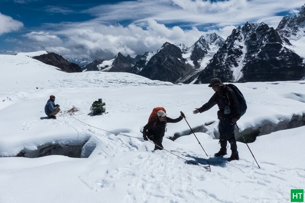
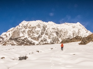
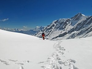
From now on we will walk along the glacier amidst high mountains all around us. Panpatia glacier is filled with crevasses and depending on summer or post monsoon, we will take a safe route. You have to camp at least a night on glacier before crossing the Panpatia col to descent.
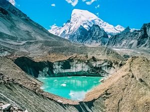
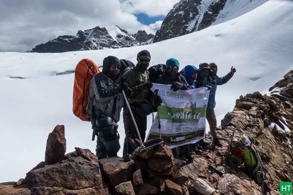
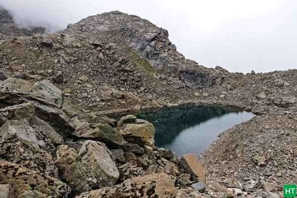
Continuing on the snowfield finally we reach the end of it to locate a narrow passage referred Panpatia Col, a.k.a Panpatia Pass. Descent from col is very steep and requires rappelling on snow in summer. Either we directly rappel or take a longer radius on boulders and loose rocks. The slope becomes relatively easier after 500 m or so. We continue on the glacier this side and climb on to the ridge left of us to reach a rectangular lake, named Sujal Sarovar.
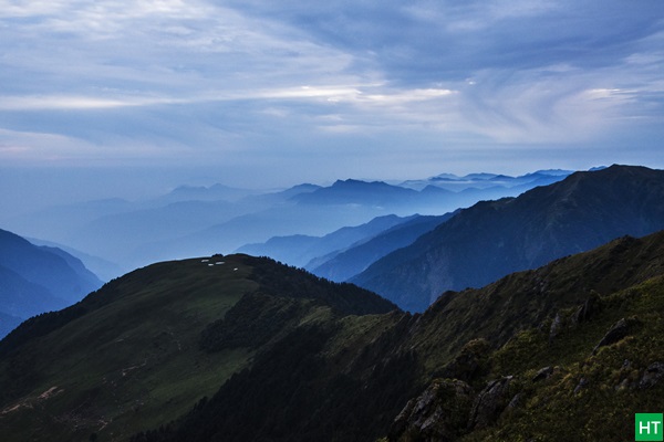
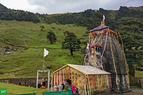
Moving forward, we continue to climb the ridge to reach a pass. From here we will go down following boulder strewn meadows to Kachni Khal. Finally you will get a trail to Madmaheshwar, which is some 9 Km down from Kachni. You can clearly locate Buda Madmaheshwar on top of the Madmaheshwar hill. Finally we hit treeline again at Madmaheshwar. Spend a night in the Dharamshala of the temple trustee board. Next, we descent to road head Ransi village, through beautiful Rhododendron and Oak forests. On the way there are villages of Bantoli, Gaundar to name a few.
Day 01: Drive from Haridwar to Joshimath – 280 km – 11/12 hours. Lodge.
Day 02: Stay at Joshimath. Acclimatisation and height gain to Auli and back – 4/5 hours. Lodge
Day 03: Drive to Benkuli – 30 Km – 1 hour – trek to Khiraon village – 5 Km – 3/4 hours. Camp
Day 04: Trek from Shepherd’s camp – 10 Km – 5/6 hours. Camp
Day 05: Trek to snout camp – 4 Km – 3 hours. Camp
Day 06: Trek to upper moraine area – 5 Km – 4/5 hours. Camp
Day 07: Trek to rock below Parvati Gully – 4 Km – 4 hours. Camp
Day 08: Trek to Panpatia glacier snowfield camp via Parvati Gully – 6 Km – 5/6 hours. Camp
Day 09: Trek to Sujal Sarovar via Panpatia Col – 10 Km – 8/10 hours. Camp
Day 10: Trek to Kachni Khal and descent to Madmaheshwar – 20 Km – 9/10 hours. Lodge/camp
Day 11: Trek to Ransi village – 16 Km – 5/6 hours. Drive to Haridwar – 235 Km – 9/10 hours.
Day 12: Mandatory buffer/reserve day (will be utilised, if required during the trek).
Like most high altitude treks going above 5000 m, Panpatia Col trek has a narrow window to complete. A month before monsoon and another just after the monsoon are suitable for this tricky and remote trail.
Now both the season has its pros and cons. You need to decide carefully which suits you better.
Depending upon last season’s snow you may get snow starting from snout or moraine camp in summer. Normally crevasses will be packed in snow this time. Expect walking on snow for 3 to 5 days.
In post monsoon snow will be minimum with the crevasses wide open. Moraine/boulder walk will be extensive for 4/5 days. Weather remains clearer in this season.
Depending upon the number of trekkers we may arrange a car pickup from Haridwar to Joshimath and return Ransi to Haridwar. You pay directly to the driver sharing equally. At present a Tata Sumo/Maxx type vehicles charge ₹ 6000 for drop from Haridwar to Joshimath. This can accommodate 5-7 persons. Similarly Ransi to Haridwar is ₹ 5000-6000. Approximately this is ₹ 2000 to ₹ 2500 per person (includes pick up and drop) when you share with fellow trekkers.
Alternatively if you wish to reach Joshimath on your own by public transportation then:
| Expertise: | 10 years on ground experience |
|---|---|
| Support staff: | Experienced and technical support plus office staff |
| Group size: | Small groups up to 10 |
| Insurance: | Travel and Medical insurance policy (covers illness, AMS, evacuation, accidents) |
| Easy Bookings: | 25% Booking Deposit |
Duration: 10 days of trekking including a buffer day; Haridwar to Haridwar in 12 days.
Prerequisite: Prior multiple high altitude trekking experiences along with good physical fitness and no reported acclimatisation issues.
Grade: Difficult, often referred “Trekking Expedition”
Physicality: 9/10
Trail Length: 80 Km
Highest Point: Panpatia Col ~ 5200 m/ 17050 ft
Seasons: Mid May to Mid June (summer) and September (Post monsoon/fall)
Further Option: From Madhyamaheshwar further trek to Kedarnath in 3/4 days.
Access: Trek starting point (trek base) is Gangotri, 245 Km from Dehradun.
Rail station: Dehradun (Station Code: DDN)
Airport: Delhi, Jolly Grant in Dehradun (Airport Code: DED)
Map:
| DEPARTURE LOCATION | Dehradun railway station |
| REPORTING TIME | 9:00 AM for a prompt departure to Uttarkashi (Day 1) |
| RETURN LOCATION | Haridwar |
| RETURN TIME | Approximately 9:00 PM (Day 16) |
Nearest Rail station: Haridwar (Station Code: HW)
Nearest Airport: Delhi, Jolly Grant in Dehradun (Airport Code: DED)
Depending upon the number of trekkers we may arrange a car pickup from Dehradun to Gangotri and return from Badrinath. This will get equally divided amongst the trekkers opting. You pay directly to the driver. At present a Tata Sumo/Maxx type vehicles charge ₹ 6000 for drop from Haridwar to Joshimath. This can accommodate 5-7 persons. Similarly Ransi to Haridwar is ₹ 5000-6000. Approximately this comes around ₹ 2000 to ₹ 3000 per person (includes pick up and drop) when you share with fellow trekkers.
Alternatively if you wish to reach Joshimath on your own by public transportation then:
For the treks in Garhwal, one has to reach Haridwar normally. Rishikesh is another 25 Km from here and is considered a gateway to Garhwal Himalayas. You can fly or by train reach New Delhi as per your convenience from any part within India.
There are direct trains from Kolkata to Haridwar.
KUMBHA EXPRESS – Train No. – 12369 ( Very good option to reach Haridwar by 5 pm; Spend the night in Haridwar and start your onward journey by car next morning)
UPASANA EXPRESS – Train No. – 12327 ( Very good option to reach Haridwar by 5 pm; Spend the night in Haridwar and start your onward journey by car next morning)
DOON EXPRESS – Train No. – 13009 (Don’t book this train when you plan a long onward journey immediately nn the same morning)]
Avoid booking wait listed (WL) tickets in AC classes (1A/2A/3A) or Chair Car (CC). Book Sleeper class (SL)/Second Sitting class (2S) tickets which have normally more seats/berth and hence much better chance to get confirmed.
Following trains are good to reach Haridwar and run daily.
DDN JANSHTBDI – Train No. 12055 (Arrives HW in the evening @ 7:30 pm, good choice when you stay the night in Haridwar and have a long drive ahead next day)
NANDA DEVI EXP – Train No. 12205 (arrives HW early morning @ 4am)
UTKAL EXPRESS – Train No. 18477 (arrives HW in the night @ 9pm)
MUSSOORIE EXP – Train No. 14041 (arrives HW in the morning @ 5:45am)
Always avoid booking waitlisted (WL) tickets in AC classes (1A/2A/3A) or Chair Car (CC). Book Sleeper class (SL)/Second Sitting class (2S) tickets which have normally more seats/berth and hence much better chance to get confirmed.
Govt. Road Transport (Roadways of Uttarakhand, Uttar Pradesh, Delhi, Haryana, Punjab etc.) buses are frequently available in day time and night from Kashmiri Gate ISBT . Tickets are available on board for these regular type buses. From Delhi Airport or Station you can reach ISBT Kashmiri Gate via Delhi Metro service (http://www.delhimetrorail.com/metro-fares.aspx). It is only 4 Km from NDLS and can be reached easily by booking an auto rickshaw.
For privately operated bus, you can book online from different portals. Select a boarding point suitably. Overnight Volvo/A.C/Push back bus service.
Trekkers reaching on the previous day before the journey to the actual trek base need to stay the night in Haridwar. There are several options in Haridwar for spending a night while staying in Premium, Standard or Budget accommodation. Options vary from Privately operated Hotels/Lodges, to State run Tourist rest House and Dharamshala.
State run GMVN (Garhwal Mandal Vikas Nigam) operates Hotel Rahi just beside the Bus Stand and opposite to the Haridwar Railway Station. This is a reliable and a decent choice for Standard accommodation.Check the following for online booking of the above: http://www.gmvnl.com/newgmvn/tour/booktrh.asp
You can call or visit GMVN nearest office or even send an email for more information.The information is available at: http://www.gmvnl.com/newgmvn/online_reservation/#
Normally you reach Haridwar from any trek base by 7/8 pm in the evening. You can take any train after 9 pm or regular bus service as mentioned above to reach Delhi or directly to your homeward journey in the same night.
Book for 5 persons or more and get flat 10% discount on TREK FEE in our any scheduled group departure date.
Inclusions:
One night’s accommodation at Joshimath (Day 1) and dinner.
All meals during the trek (starting from Day 2 breakfast and ending with Day 11 lunch). Regular Indian style nutritious vegetarian food including eggs during the trek, breakfast packed/hot lunch (depending upon the time you reach a campsite), snacks, dinner along with coffee/tea/soup.
Excellent trekking guide, who will be a local to this particular area and has profound knowledge of the trekking trails around. We will provide one guide for every 5 trekkers. At least one guide will be mountaineering course(s) certified.
Specialised Cook, Support staff, High Altitude Porters (HAP) for carrying the central logistics of the trek.
Stay in tents (2/3 persons dome shaped tents) on sharing basis during the trek.
Camping equipment like Sleeping bag, Carry mattress. (Bring your own sleeping if you have a high altitude specific personal Sleeping Bag. This is always better for hygienic reasons.). Any technical equipment like static/dynamic rope, carabiners, sling, ice axe, gaiters, micro spikes/crampon etc.
Kitchen tent and toilet tent as required during the trek.
All permit fee, camping charges, forest levy required for the trek.
Basic Medical & First Aid kit.
Travel and Medical insurance policy (covering illness, AMS, evacuation, accidents etc) covering high altitude trekking and mountaineering up to 6500 m. (For Indian nationals it is included in the TREK FEE, up to 60 years of age). It covers your trek as well as your return journey to Haridwar.
Exclusions:
Transportation from Haridwar to Joshimath and return from trek end point Ransi .(₹ 2000 – 3000 per person for the pick up and drop when shared with fellow trekkers)
Note that offloading of rucksack is NOT permitted on this trek. You need to carry your own backpack along with all your personal belongings, sleeping bag and sleeping mattress (provided by HT or your personal one). This is mandatory for a difficult trek and is aimed at the safety of the trekkers individually. A trekker must be physically fit to carry a rucksack of 12 to 15 kg comfortably on high altitude.
Cost of buffer/reserve day, i.e. Day 16. If we use this during trekking, you need to pay additional ₹ 5000. This will be collected at Ransi after the trek.
Any tip/gratuity to the HT supports staff.
Anything which is NOT mentioned in the “Inclusions” or personal in nature.
If you need more clarifications write in to [email protected]
Check a nice Panpatia blog and tips here.
Uttarakhand
Kalindi Khal Trek: If you are an avid trekker on Indian Himalayas and hanging around for some time, Kalindi Khal trek (same…
Uttarakhand
Auden’s Col with Mayali Pass Trek: A journey from Gangotri to Kedarnath Many experienced hikers arguably claim Auden’s Col trek as the…
Uttarakhand
Kedarkantha Snow Trek – Dec’24 to March’25 Updates for Kedarkantha trek: Upcoming group departure for Kedarkantha trek (Nov to March) from Dehradun.…
Tour Reviews
There are no reviews yet.
Leave a Review