- Camping
- Difficult Treks
- Fall Treks
- Garhwal Treks
- More than 15 Days
- Summer Treks
- Trekking Expeditions
- Uttarakhand
Kalindi Khal Trek:
If you are an avid trekker on Indian Himalayas and hanging around for some time, Kalindi Khal trek (same as Kalindi Pass trek) has been surely ringing in your ears by now. Maybe you have already this in your bucket list too, as this is probably the “most sought-after trek in Indian Himalayas”. At the same time certainly you have heard scary incidents and challenges on this incredible route. A trek like Kalindi Khal has plenty of overwhelming reasons to venture out and at the same time needs detailed understanding of the trail, adequate experience, and last but not the least – a suitable weather window to safely complete this epic trek.
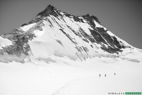
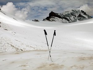
The below picture gives you an idea how it may look like on a clear day, looking towards north from the pass. The view from the pass is surely unparalleled and unique.
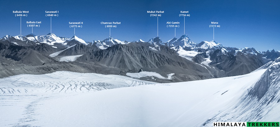
This 100 Km long trail (shortest motorable route is 425 Km!) connects two holy shrines of Gangotri and Badrinath over a glaciated pass almost at 6000 m. Undoubtedly it is the very core of Himalayas, rugged, arid, raw nature at its best. Unpredictable weather, difficult terrain, awkward campsites and acclimatisation challenges will surely test your physical and mental endurance.
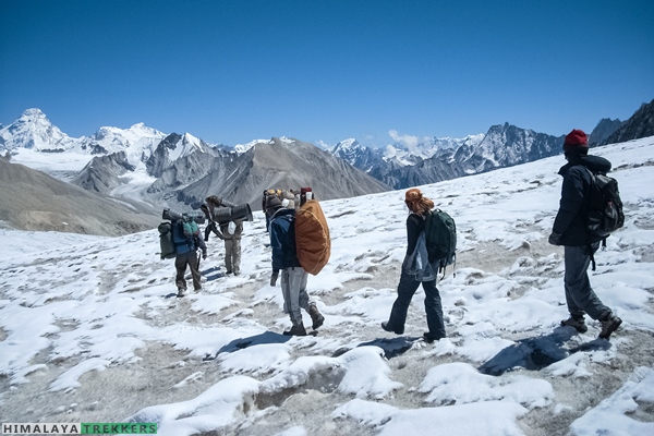
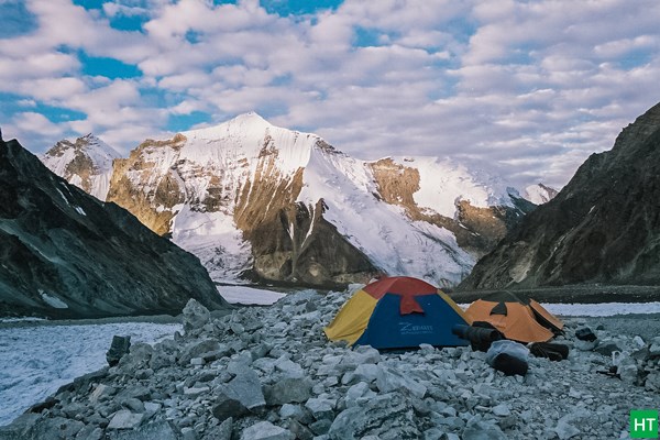
Apart from endless peak panorama, this trail literally traverses through the very base of high Himalayan peaks, e.g. Shivling (6543 m), Vasuki Parbat (6792 m), Satopanth (7075 m), Chandra Parbat (6728 m), Avalanche peak (6196 m) and more. Green patch of Nandanvan meadows set a contrast in the barren landscape.
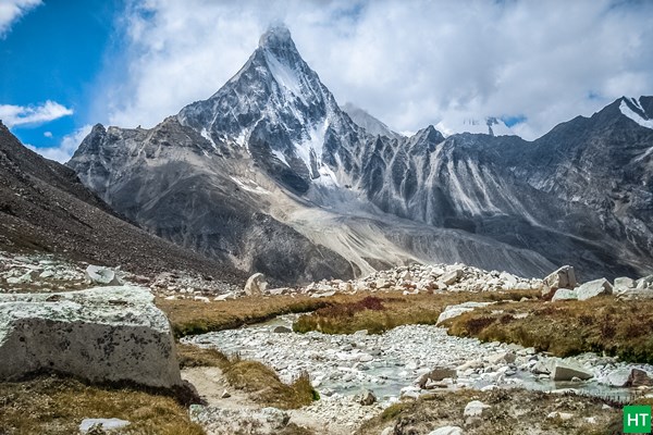
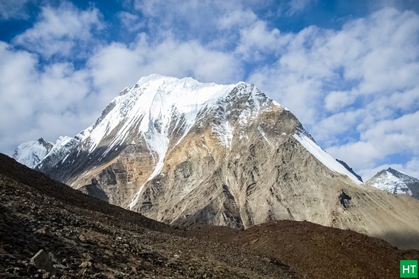
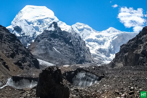
Initially the trail from Gangotri to Bhojbasa is gentle, along Bhagirathi, upstream. After Bhojbasa the glacier valley features abruptly. From Gaumukh onward sometime inside Gangotri glacier and higher glacial valleys.
Treeline already starts receding just after Gangotri and oxygen level is significantly less on this trail. At above 19000 ft above sea level Oxygen is as low as 50% that of mean sea level.
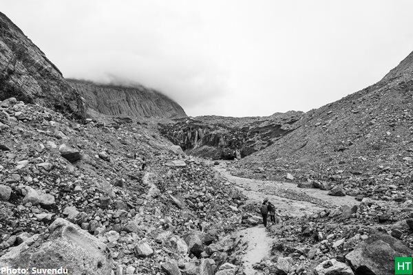
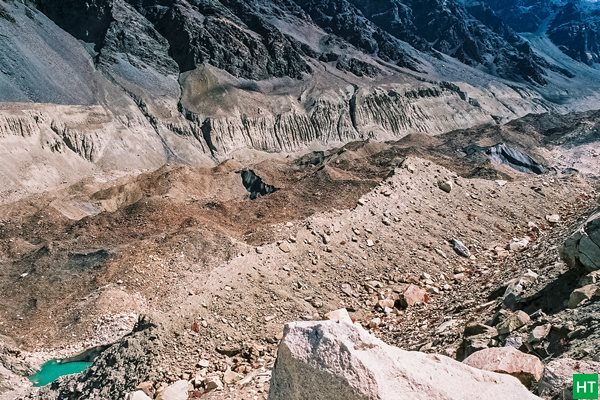
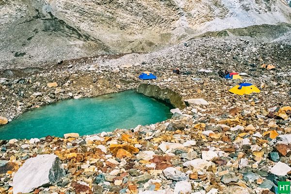
This is a also a trail to follow glaciers and hopping on moraines. You will witness dangerously beautiful glaciers in all forms and colours possible from rocky debris and black ice to pristine blue ice. The major glaciers enroute are Gangotri, Raktavarna, Chaturangi, Suralaya, Shweta and Raj Parav.
Kalindi Khal trek – Prerequisites:
- A trekker must have completed at least 5 high altitude treks going above ~ 4500 m/15000 ft.
- A minimum of 2 Difficult grade treks reaching beyond 5000 m/16500 ft e.g. Pin Parvati Pass, Ronti Saddle, Parang La etc.
- A trekker must be in excellent physical condition along with NO prior acclimatisation issues on high altitude.
Itinerary for the Kalindi Khal Trek:
Day 1: Drive from Dehradun (least by 6 a.m.) to Gangotri ( 3100 m/1017 ft.) – 250 Km – 12 hours Lodge accommodation.
Day 2: Trek to Chirbasa ( 3580 m/11750 ft) – 9 Km, 3/4 hours. Camp.
Day 3: Trek to Bhojbasa ( 3780 m/12400 ft)—5 km—2/3 hours. Camp. Post lunch, we hike to(wards) Gaumukh (4050 m/13285 ft) for an acclimatisation walk. This is a return trip of approximately 3 hours.
Day 4: Trek to Tapovan (4350 m/14270 ft)—8 Km—4/5 hours.
Day 5: Trek to Nandanvan (~ 4450 m/14600 ft) , 4–5 hours. From today, we will walk primarily on moraine till the pass base and the trail keeps changing from season to season.
Day 6: Rest and acclimatisation at Nandanvan.
Day 7: Trek to Vasuki Tal (~ 4900 m/16070 ft, 6 Km, 4 hours).
Day 8: Trek to Khara Patthar – 4/5 hours.
Day 9: Trek to Shweta Glacier, 4/5 hours.
Day 10: Trek to Kalindi base camp – 5/6 hours.
Day 11: Ascent to Kalindi Pass (~ 5945 m/19500 ft) and descent to Raj Parav (13 Km, 8–10 hours).
Day 12: Trek to Arwa Tal/Arwa Nala (13 Km, 5-6 hours).
Day 13: Trek to Ghastoli, 12 Km, 5- 5/6 hours. Camp.
Day 14: Trek to Mana village (about 15 Km, 5 hours) and then trek to Badrinath 3 Km – Lodge accommodation.
Day 15: Drive to Rishikesh/Haridwar (10/11 hours).
Day 16: Buffer/Reserve Day (mandatory and will be utilised if required during the trek).
Important Notes:
- You need to reach Dehradun on Day 1 latest by 6 am. Arrange your return train/bus tickets from Haridwar on Day 16 evening after 7 pm.
- It maybe particularly helpful to use a Day 0 at Uttarkashi town or Gangotri due to paper works/permit/acclimatisation etc.
- Distance on the moraine is hard to assess plus the trail keeps changing year over year. Estimated Trekking trail length is ~ 90 Km.
Seasons for Kalindi Khal trek:
Like all high altitude treks you can do Kalindi Khal trek in following two seasons:
- Summer: Mid May to Mid June
- Post Monsoon/Fall: September
Access to trek base (Gangotri, 250 Km from Dehradun):
Depending upon the number of trekkers we may arrange a car pickup from Dehradun to Gangotri and return from Badrinath. This will get equally divided amongst the trekkers opting. You pay directly to the driver. At present a Tata Sumo/Maxx type vehicles charge ₹ 8000 for drop from Dehradun to Gangotri. This can accommodate 5-7 persons. Similarly Badrinath to Haridwar is ₹ 9000. Approximately this comes around ₹ 3000 to ₹ 4000 per person (includes pick up and drop) when you share with fellow trekkers.
Alternatively if you wish to reach Gangotri on your own by public transportation then:
- There is a direct bus from Haridwar (Roadways bus stand, opposite to railway station) to Gangotri starting at 4 am. These depends on season and road conditions. Almost 300 Km tiring journey can take 13/14 hours.
- From Dehradun take morning bus at 5 am (just beside railway station) for Uttarkashi town or you can get shared vehicle/Tata Sumo. Reach Uttarkashi by latest 2 pm. There is a bus from Uttarkashi to Gangotri which starts 2/2:30 pm. Also you will get shared vehicle/Tata Sumo to Gangotri.
Download the list of things to carry in Kalindi Khal trek or check here
Why treks with HT?
| Duration | 16D/15N |
|---|---|
| Physicality | 9/10 |
| Highest Point | 5945 m/19500 ft |
| Trail Length | 100 Km |
| Grade | Difficult |

Tour Reviews
There are no reviews yet.
Leave a Review