Gaumukh Tapovan Trek:
Tapovan trek group departure on 4th May 2025 as per the itinerary from Dehradun.
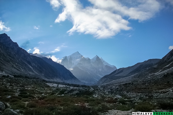
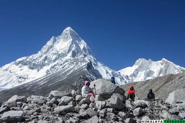
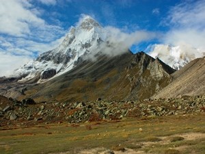
Tapovan trek is a strikingly different type of trail inside Bhagirathi river valley to high up at the base of majestic Mt. Shivling. Tapovan (4,270 m/14,270 ft) a patch of green, situated on the west bank of Gangotri glacier amidst glacial moraine and debris. This is among few known trails which takes you to a the core of the Himalayas inside a glacial valley.
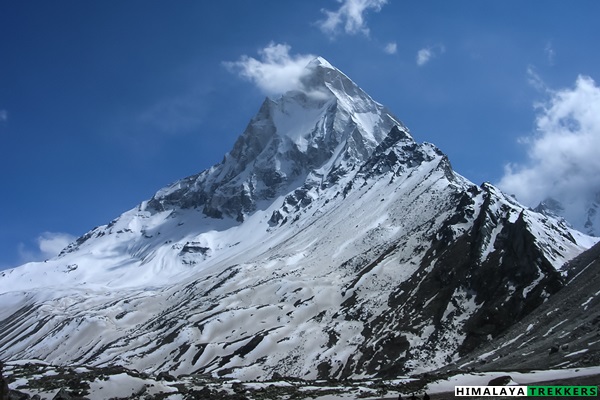
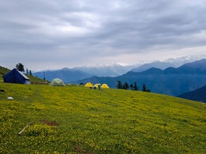
The word ‘Tapovan’ means a sacred and serene place, where the sages meditate for spiritual bliss. According to Hindu mythology, King Bhagiratha (Lord Rama’s ancestor) of the Ikshvaku dynasty, meditated here to Shiva for Ganga’s descent to the earth. From time unknown, Hindu sadhus or spiritualists come here to pay tribute to Lord Shiva and River Ganges. Tapovan, lush green in summer, blooming with wild flowers, turns golden in post-monsoon season.
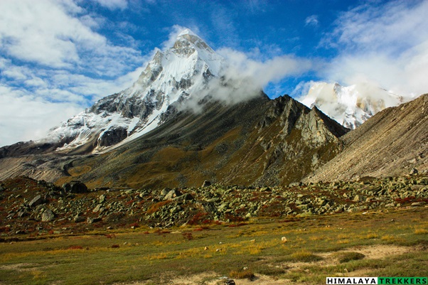
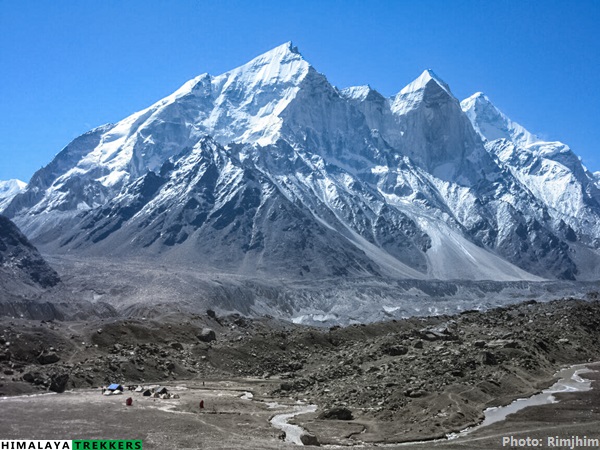
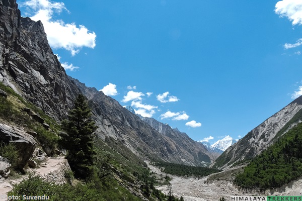
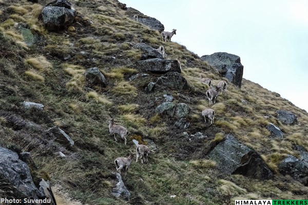
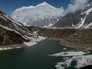
The valley, flanked by majestic Himalayan peaks like Mt. Shivling (6543 m), Mt. Meru (6630 m) and Kedar Dome (6808 m) is a favourite destination for trekking enthusiastic, both Indians and foreigners. The Bhagirathi Group of peaks – I (6,856 m), II (6,512 m) and III (6,454 m) are visible on the eastern bank of Gangotri glacier. The trail from Gangotri to Tapovan via, Bhujbasa and Gomukh, is only 24 km and two days trek but it covers a vast array of Geo-morphological features, like the ‘I’ shaped river gorge of Ganges, then the snout of the glacier from where the river originates, followed by the glacier itself with lateral moraine and ice covered glacial debris and finally the steep edge of the glacier. Initially the trail runs amidst pine and birch forest, but crosses the tree line to reach this Alpine meadow where only perennial grasses, sedges, and forbs can survive. Sighting of Bharals (Blue Mountain Sheep) on nearby mountain slopes is common. The high altitude, rarity of oxygen, average 6-7 km walk in the difficult terrain and the erratic weather make this a short but challenging trek.
Brief itinerary for Gaumukh Tapovan trek:
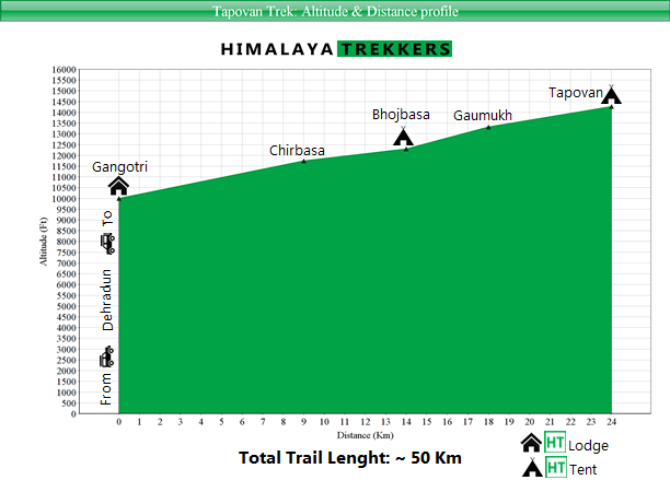
Day 1: Drive from Dehradun to Gangotri (~ 3100 m/10170 ft) – 245 km – 12 hours. Lodge accommodation.
Day 2: Trek to Chirbasa (~ 3580 m/11750 ft) – 9 km – 4/5 hours. Camp.
Day 3: Trek to Bhojbasa (~ 3780/12400 ft)– 5 km – 2/3 hours. Camp. Post lunch we hike to(wards) Gaumukh – (~ 4050 m/13285 ft) for an acclimatisation walk. This is a return trip of approx 3 hours.
Day 4: Trek to Tapovan (~4350 m/14270 ft) – 8 Km – 5/6 hours. Camp
Day 5: Early morning explore Tapovan meadows and after breakfast descent to Bhojbasa – 6/7 hours. Camp
Day 6: Trek back to Gangotri – 14 km – 4/5 hours. Lodge accommodation.
Day 7: Drive to Dehradun – 245 km – 11/12 hours.
Day 8: Mandatory buffer day. If we utilise this day during the trek, you need to pay an additional ₹ 3000 for the same. Our staff will collect this amount on spot.
Note:
- You need to reach Dehradun latest on Day 1 by 6 am or previous Day 0. You will return to Dehradun on Day 7 (or Day 8 if buffer day is utilised ) by 7-8 pm. Arrange your tickets accordingly.
- Prior high altitude trekking experiences are mandatory and you need to submit Medical Certificate.
Altitude and distance profile graph for Tapovan trek:
Seasons for Tapovan trek:
Like all high altitude treks you can do Tapovan trek in following two seasons:
- Spring Summer: Mid April to June
- Post Monsoon/Fall: September & October
Why Tapovan trek is NOT suitable for a reasonably fit beginner?
There are quite a few Moderate grade treks which we suggest in planning of your first time trek on the Himalayas. However Tapovan being also graded as “Moderate” but NOT really a trail which we recommend as your first trek. It isn’t the highest altitude of this trail which is too high, rather the trail reaches relatively lower highest altitude.
The trail till Bhojbasa is relatively easy on wide track. Things start changing as you approach towards the Gangotri glacier’s famous snout Gaumukh. On popular “Moderate” treks like Roopkund, Rupin, Goecha La and others you don’t need to negotiate a glacier, more specifically on deposited moraine. Moraine is rocks, boulders, scree and debris carried down by the glacier. One Km hopping on this terrain can be physically demanding as twice the distance. It takes 3/4 hours to cross Gangotri glacier breath-wise and the the final climb to Tapovan, for a reasonable fit and well acclimatised person. Prior trekking experience(s) will prepare you both physically and mentally for this challenge.
Furthermore this glacier valley lacks oxygen, resulting in more challenges from acclimatisation perspective. Our itinerary has a full rest and acclimatisation day at Gangotri, still a considerable number of trekkers struggle to cope with rarefied oxygen on difficult terrain. Acclimatisation problem can happen to anyone, but people with prior acclimatisation problem will face problem on this trail for certain.
We recommend Tapovan trek to trekkers who have at least twice been on high altitude treks (on or above ~4000 m/13000 ft) with good physical fitness and no prior acclimatisation issues reported.
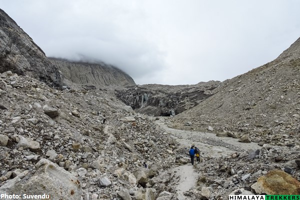
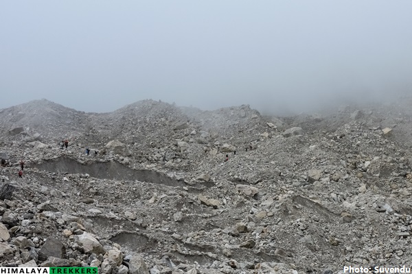
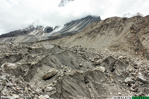
Changes in Gangotri glacier and Gaumukh snout :
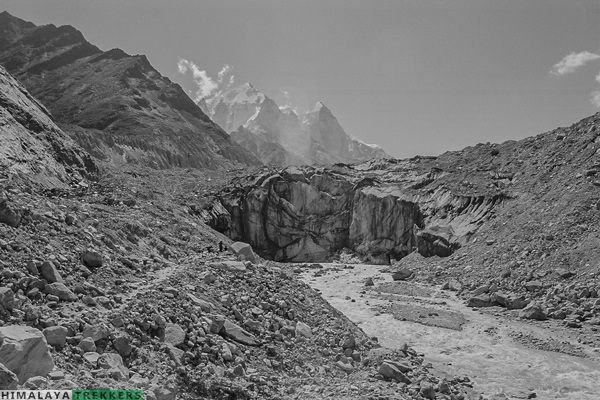
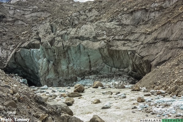
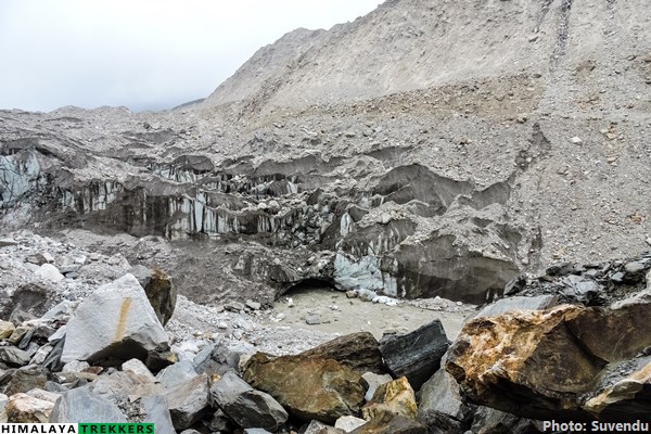
There is no debate now on that the “Climatic change” is affecting the Himalayas in general. Increase of receding glaciers are alarming for quite sometime. Gangotri glacier is a prominent example. The glacier retreated more than a kilometre in last 30 years or so. We organised our first trek to Tapovan back in 2011 and since then observed the trail course. On glacier and moraine trekking groups keep changing their path suitable up to Tapovan almost every year. A study of NASA in the beginning of millennia can be found here.
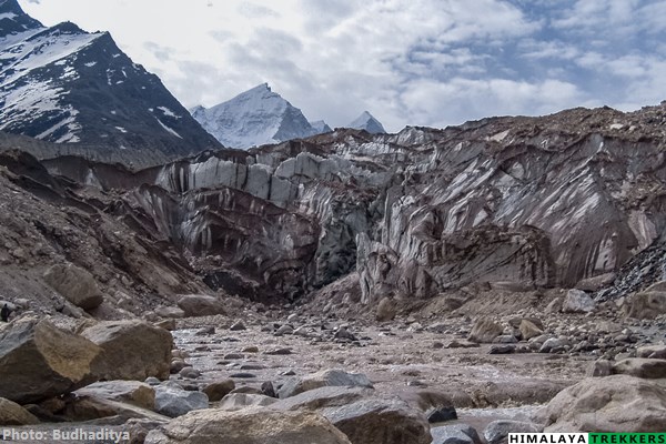
Access to trek base Gangotri (250 Km from Dehradun):
Depending upon the number of trekkers we may arrange a car pickup from Dehradun to Gangotri and back. This will get equally divided amongst the trekkers opting. You pay directly to the driver. At present a Tata Sumo/Bolero type vehicles charge approx ₹ 10,000 for drop from Dehradun to Gangotri, one way. This can accommodate up to 7/8 persons.
Alternatively if you wish to reach Gangotri on your own by public transportation then:
- There is a direct bus from Haridwar (Roadways bus stand, opposite to railway station) to Gangotri starting at 6 am. These depends on season and road conditions. Almost 300 Km tiring journey can take 13/14 hours.
- From Dehradun take morning bus at 5 am (just beside railway station) for Uttarkashi town or you can get shared vehicle/Tata Sumo. Reach Uttarkashi by latest 2 pm. There is a bus from Uttarkashi to Gangotri which starts 2/2:30 pm. Also you will get shared vehicle/Tata Sumo to Gangotri.
Download the list of things to carry in Tapovan trek or check here
Duration: 5 days of trekking; Dehradun to Dehradun in 8 days with a buffer day.
Prerequisite: Prior high altitude trekking experience along with good physical fitness.
Grade: Moderate
Physicality: 7/10
Trail Length: 50 Km
Highest Point: Tapovan ~ 4350 m/14270 ft
Seasons: May/June (summer) and September/October (Post monsoon/fall)
Further Option: Side trip to Kirti Bamak or Sumeru Bamak/ Trek to Nandanvan/Vasuki Tal by crossing the Gangotri glacier (Difficult grade)
Access: Trek starting point (trek base) is Gangotri, 245 Km from Dehradun.
Rail station: Dehradun (Station Code: DDN)
Airport: Delhi, Jolly Grant in Dehradun (Airport Code: DED)
Map:
Upcoming scheduled dates for Tapovan trek:
- You can check the scheduled Fixed Departure dates in the calendar available inside Booking Form or inside REGISTER NOW form. Tour starting Dates are highlighted as per our itinerary (Day 1 of 8 days itinerary).
- At present BOOK NOW functionality is disabled. You can get all the information in your email by submitting the REGISTER NOW form.
- If you are a group of people and available dates are not matching then you may select Custom date mode (by clicking the Select your custom date) and fill in the displayed form.
- You can also check all the available dates at a glance in our TREK CALENDAR.
- Trekkers need to reach Dehradun on Day 1 morning (latest by 7 am) or the previous night. Return to Dehradun on Day 8 evening (around 6 pm). Arrange your tickets for inward journey and return accordingly
| DEPARTURE LOCATION | Dehradun railway station |
| REPORTING TIME | 6:00 AM for a prompt departure to Gangotri (Day 1) |
| RETURN LOCATION | Dehradun |
| RETURN TIME | Approximately 6:00 PM (Day 8) |
How to reach Gangotri (The trek base):
Nearest Rail station: Dehradun (Station Code: DDN)
Nearest Airport: Delhi, Jolly Grant in Dehradun (Airport Code: DED)
Based upon your request we will arrange a pick up and drop from Dehradun to Gangotri and back. This will be shared equally by the team members on actual basis. You pay directly to the driver/transporter. The fare is Rs 7000 for a Tata Sumo/Mahindra Maxx one way. This can accommodate 6 to 8 people. A Tempo Traveller charges Rs 11000 (12-14 seat) one way. This is NOT included in TREK FEE and to be payable directly to the driver/owner.
If you wish to reach our Trek Base Sankri on your own by public transportation:
- There are 2/3 privately operated buses from Dehradun (near DDN railway station on Gandhi road) To Sankri. The 200 Km journey will take around 10/12 hours. The busses start at 5:30/6/7 am.
- While returning from Bhatwaria take the morning bus to Dehradun/Vikasnagar and reach by 7 pm.
How to reach Dehradun:
For the treks at Uttarkashi district in Garhwal , one has to reach the capital city of Uttarakhand, Dehradun, specially the trek starting from Sankri, Yamunotri etc. Haridwar, Rishikesh and Dehradun are 3 nearby cities in the area and one can move from one to another by public vehicles like bus or shared Jeeps.
For more options to reach Haridwar you can check here.
Haridwar to Dehradun: 55 Km and may take one and half to 2 hours.
Dehradun to Rishikesh: 45 Km and may take around one and a half hour.
You can fly or by train reach New Delhi as per your convenience from any part within India.
There are direct trains from Kolkata to Dehradun.
KUMBHA EXPRESS – Train No. – 12369 ( Very good option to reach Haridwar by 5 pm; You can take a bus from the terminus just opposite to the railway station referred as Roadways bus stand/ISBT and reach Dehradun in one and half hour. Spend the night in Dehradun and start your onward journey by car next morning.)
UPASANA EXPRESS – Train No. – 12327 ( Very good option to reach Dehradun directly by 5 pm; Spend the night in Haridwar and start your onward journey by car next morning)
DOON EXPRESS – Train No. – 13009 (Don’t book this train when you plan a long onward journey immediately in the morning)]
Avoid booking wait listed (WL) tickets in AC classes (1A/2A/3A) or Chair Car (CC). Book Sleeper class (SL)/Second Sitting class (2S) tickets which have normally more seats/berths and hence much better chance to get confirmed.
You can reach Dehradun easily from New Delhi by train or bus (~ 6/7 hours) and is around 260 Km.
By train:
Following trains are good to reach Haridwar and run daily.
DDN JANSHTBDI – Train No. 12055 (Arrives DDN in the evening @ 9:10 pm, good choice when you stay the night in Dehradun and have a long drive ahead next day)
NANDA DEVI EXP – Train No. 12205 (arrives DDN early morning @ 5:40 am)
Always avoid booking waitlisted (WL) tickets in AC classes (1A/2A/3A) or Chair Car (CC). Book Sleeper class (SL)/Second Sitting class (2S) tickets which have normally more seats/berth and hence much better chance to get confirmed.
By bus:
Govt. Road Transport (Roadways of Uttarakhand, Uttar Pradesh, Delhi, Haryana, Punjab etc.) buses are frequently available in day time and night from Kashmiri Gate ISBT (http://www.delhi.gov.in/wps/wcm/connect/doit_transport/Transport/Home/ISBT/Fare+Chart). Tickets are available on board for these regular type buses. From Delhi Airport or Station you can reach ISBT Kashmiri Gate via Delhi Metro service (http://www.delhimetrorail.com/metro-fares.aspx). It is only 4 Km from NDLS and can be reached easily by booking an auto rickshaw.
For privately operated bus, you can book online from different portals. Select a boarding point suitably. Overnight Volvo/A.C/Push back buses are available. Normally these buses take up to 7 hours to reach Dehradun ISBT. You can book an auto rickshaw for Railway Station (5 Km away)/Hotel Drona (GMVN) or take a shared auto (Route No. 5) from ISBT.
[There are two major bus terminus in Dehradun. The buses from Delhi/Haridwar goes to the ISBT (Inter State Bus Terminus) and the other one is the Parvatiya Depot (Hill Depot, from where you can get the buses going up the hills like Uttarkashi, Barkot, Purola etc) located just beside the Railway station.
Nearest Airport Jolly Grant is 25 Km away from Dehradun. book a private taxi to reach Dehradun city. This airport is accessed from Dehradun, Haridwar and Rishikesh easily. The flights are mostly via Delhi.
For night stay in Dehradun:
Trekkers reaching on the previous day before the journey to the actual trek base need to stay the night in Dehradun. There are several options in Dehradun for spending a night while staying in Premium, Standard or Budget accommodation. Options vary from Privately operated Hotels/Lodges, to state run Tourist Rest Houses.
State run GMVN (Garhwal Mandal Vikas Nigam) operates Hotel Drona complex is 10 minutes walking from the railway Station. You can book an auto rickshaw. From ISBT it is around 5 Km. You can book an auto rickshaw to Hotel Drona (GMVN) or take a shared auto (Route No. 5) from ISBT (Inter State Bus Terminus). This is a reliable and a decent choice for Standard accommodation. The have restaurant and room service.
Check the following for online booking of the above: http://www.gmvnl.com/newgmvn/tour/booktrh.asp
You can call or visit GMVN nearest office or even send an email for more information.The information is available at:
http://www.gmvnl.com/newgmvn/online_reservation/#
Return from Dehradun:
Normally you reach Dehradun from any trek base by 6/7 pm in the evening. You can take any train after 9 pm or regular bus service as mentioned above to reach Delhi or directly to your homeward journey in the same night.
Access to Gangotri (The trek base): Depending upon the trek members we can arrange a pick up from Haridwar to Gangotri and back to Haridwar. This will be shared by the team members on actual basis.
Otherwise if a trekker wants to reach Sankri by public vehicle then here is how:
1)Take early moning bus from Haridwar to Uttarkashi from the Roadways/ISBT bus stand (opposite to Railway station) or a private one from G.M.O.U bus stand ( on the same main road, 2 minutes walk). This will take 7/8 hours. Change the bus to Gangotri (starts around 2 pm in the afternoon) from here, which will take 4/5 hours to cover the remaining 100 Km.
2) While returning from Gangotri take the morning bus to Uttarkashi and then then change to Haridwar/Rishikesh.
Drive from Dehradun to Gangotri (3050 m/10000 ft) – 245 Km - 11/12 hours
Rest and active acclimatisation day at Gangotri
Gangotri (3050 m/10000 ft) to Bhojbasa (3750 m/12300 ft) via Chirbasa (3580 m/11745 ft) - 14 Km - 6/7 hours
Bhojbasa (3750 m/12300 ft) to Tapovan (4350 m/14270 ft) via Gaumukh (4060 m/13320 ft) - 10 Km - 6/7 hours
Rest and exploration day at Tapovan (towards Neelatal or Sundarvan/Kedar Dome base region
Trek down to Chirbasa - 15 Km - 6/7 hours
Trek to Gangotri – 9 Km - 3 hours; Drive to Bhatwari - 75 Km - 3 hours hours
Drive from Bhatwari to Dehradun – 175 Km - 8/9 hours
P.S.: Distances and altitudes are approximate and may not be exact.
TREK FEE: ₹ 17,950 (Gangotri to Gangotri) + 5% GST
The above TREK FFE is applicable in case of available Fixed Group Departure(s). For a customised tour, the same rate will be applicable for a group of 8 to 10 persons.
Inclusions:
2 night’s lodge accommodation at Gangotri (Day 1 & Day 6) on a sharing basis and dinner.
All meals during the trek. Regular Indian style nutritious vegetarian food during the trek, breakfast packed/hot lunch (depending upon the time you reach a campsite), snacks, dinner along with coffee/tea/soup.
Excellent trekking guide, who will be a local to this particular area and has profound knowledge of the trekking trails around.
Specialised Cook, Support staff, Porters/Packed Animals for carrying the central logistics of the trek.
Stay in tents on a twin sharing basis during the trek.
Camping equipment like Sleeping bag, Carry mattress, Gaiters, Micro spikes/Crampon. (Bring your own sleeping bag, if you have a high altitude specific personal Sleeping Bag. This is always better for hygienic reasons.)
Kitchen, dining and toilet tent as required during the trek.
All permit fee, camping charges, forest levy required for the trek.
Basic Medical & First Aid kit.
Travel and Medical insurance for a duration of 7 days for Indian nationals upto 60 years of age.
Exclusions:
Transportation from Dehradun to Gangotri and return (₹ 3000 – 4000 per person for the pick up and drop when shared with fellow trekkers). Tata Sumo charge is ₹ 10,000 per vehicle (5 to 6 persons), one way.
We assume that you will carry your personal Rucksack/Backpack with all your personal belongings. If you want to offload your Rucksack and be carried by Porter then you need to pay an additional ₹ 3500 for the entire duration of the trek. The Rucksack must be within 10 kg weight.
₹ 2500 + 5% GST per person additional charge for foreigners towards various permits/entry tickets/levies.
Any tip or gratuity to the HT support staff.
Anything that is NOT mentioned in the “Inclusions” or personal in nature.
Booking:
- We assume that you have read and understood our “Terms & Conditions” (https://dev.himalayatrekker.com/terms-and-conditions) before Booking a trek/tour.
- To reserve your place in a scheduled Fixed Departure trek or a Customised/Private trek pay 25% of the TREK/TOUR FEE as the initial “Booking Deposit”. You can pay by Net banking/Draft/Cheque/Credit/Debit/AMEX cards. This will ensure your participation in the desired trek and we will reserve your place in the scheduled date. You need to pay the remaining amount at least 15 days before Trek Starting Date.
- If you book a Trek/Tour before 14 days or less from Trek/Tour Starting Date, you need to pay the full TREK/TOUR FEE.
Cancellations:
- “Booking Amount” i.e.25% of the TREK/TOUR FEE is Non-Refundable at any stage.
- If in case you are not able to make it due to unavoidable reason(s), we provide you avery flexible choice of Shifting to another trek within next one year. One year is counted from the starting date of the trek/tour you booked initially with us.
- In case you postpone your trip you need to informminimum of 15 days before the trek/tour starting date. (Though we suggest to inform us earlier if known)
- In case you postpone a trek/tour before 15 days of the scheduled Trek/Tour Starting date or prior, you may shift to another group of the same trek/tour scheduled in the same season or within next one year. You may shift to another suitable route also. For changing any, you need our approval first. Your request must be in written communication through your registered email with us.
- If you cancel/postpone a trek/tour from 14 days to 8 days before tour starting date, your Booking Amount is Non-Refundable. We will not take any request of shifting dates. We will charge 50% of the amount as Cancellation Charges and process refund of remaining 50%. You may also shift to another group within next year but 25% Booking Amount will be deemed as Cancellation Charge and the rest amount will be transferred to the shifted group.
- If you cancel a trek/tour 7 days (i.e. a week) before Trek/Tour Starting Date or later, there will be NO REFUND.
- In case of any unforeseen incident including but not limited to natural calamities like flood, earthquake, landslide, forest fire or any political unrest, if we are compelled to cancel the trek/trip, you will be entitled to redeem the full amount for the same/similar kind of trek/trip within next one year.
If you need more clarifications write in to info@himalayatrekker.com




Tour Reviews
There are no reviews yet.
Leave a Review