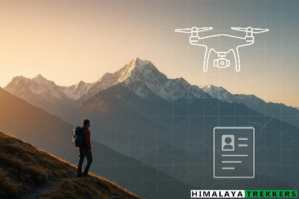
Context: This is a field guide for trekkers and trek leaders planning to carry camera drones in the Indian Himalayas. It summarises what’s allowed, where you cannot fly, and what permissions you actually need—then maps common consumer drone models to real-world do’s & don’ts.
Also read: All-in-One Guide to Trekking Permits in the Indian Himalayas (Hub)
How India regulates drones (quick framework)
Green / Yellow / Red zones (Digital Sky)
India uses a live airspace map on the DGCA Digital Sky portal. Green zones are generally permitted without prior permission; Yellow zones (e.g., controlled airspace near airports) need ATC permission; Red zones are no-drone unless the Central Government specifically authorises. Always check the map on the day you fly; zones can change.
The 25-km international border belt
India’s official airspace map marks a 25 km belt along international borders as restricted for drones. Treat the entire belt—covering large parts of Ladakh, J&K, Himachal, Uttarakhand, Sikkim and Arunachal border valleys—as no-drone unless specifically authorised by the Centre.
Registration & pilot certification basics
- Registration (UIN): “No person shall operate a drone without first registering it on Digital Sky and obtaining a Unique Identification Number (UIN), unless exempted by the Drone Rules.” Nano/model and certain R&D scenarios have specific exemptions; most consumer craft ≥250 g require UIN.
- Remote Pilot Certificate (RPC): Not required for nano (≤250 g) and for non-commercial micro drones; required for other categories. Training/issuance runs via DGCA-authorised drone schools.
- Import: Consumer drone imports are restricted (ban since 9 Feb 2022) except for R&D/defence etc.; components remain “free.” Use legally-sourced, India-sold units and ensure your model is eligible for registration on Digital Sky.
National Parks & Wildlife Sanctuaries: assume no-drone without written CWLW sanction
Filming inside Protected Areas is governed by the Wild Life (Protection) Act and MoEFCC terms. Those conditions explicitly state: “Use of aircraft will not be permitted.” Since drones are classified as aircraft in the drone framework, treat PAs (e.g., Khangchendzonga NP, Singalila NP, GHNP, Valley of Flowers) as no-drone unless you hold a rare, written exemption from the Chief Wildlife Warden. Some states (e.g., West Bengal) add an explicit “No drones” clause in filming conditions for PAs. Gate staff/check-posts will enforce this.
Common models & what’s allowed: a trekker’s mapping
Examples are illustrative; always verify your exact model’s status on Digital Sky and current airspace before flight.
| Model (examples) | Category | AUW (g) | Where you may fly | Hard NOs |
|---|---|---|---|---|
| Sub-250 g camera drones (DJI Mini 4 Pro / Mini 3 series, Autel Nano) | Nano (≤250 g) | 249 | Green zones only, outside Protected Areas and outside the 25-km international-border belt; follow local directives. RPC not required; check UIN/registration exemptions and eligibility. | Protected Areas without CWLW letter; Red zones incl. 25-km border belt; Yellow zones without ATC permission. |
| DJI Air 3, Mavic 3 series (typical) | Micro (>250–≤2000 g) | 600–900 | Green zones with UIN. Non-commercial micro flights may not need RPC; commercial work requires RPC per DGCA. | Protected Areas without CWLW sanction; Red zones; Yellow zones without ATC permission; any temporary restrictions. |
| Heavier/pro rigs (>2 kg) | Small/Medium | >2000 | Green zones with UIN + RPC and any additional clearances as applicable. | Protected Areas without CWLW sanction; Red/Yellow zones without required permissions; border-belt areas. |
Checklist before any Himalayan drone flight
- Check Digital Sky airspace map the morning you fly; screenshot the layer.
- Carry permit printouts (UIN/RPC where applicable) + ID.
- Never fly inside a National Park/WLS without a written CWLW exemption. When in doubt, don’t launch.
- Stay well away from any military/ITBP/BSF/SSB installation or road; never film checkpoints.
Annexure — Official links
- DGCA Digital Sky — Airspace Map: https://digitalsky.dgca.gov.in/airspace-map/
- Drone Rules, 2021 (Govt features note): PIB explainer PDF
- Drone Rules (amendments/updates listing): Digital Sky – Regulations
- Drone airspace map press note (zones; yellow reduced to 12 km; red = no-drone except by Centre): PIB press release
- DGFT import policy — ban on importing drones (components free): Notification 54/2015-2020
- MoEFCC filming terms in Protected Areas (explicit: “Use of aircraft will not be permitted”): Overview | Terms PDF
- West Bengal Forest (PA filming conditions) — “No drones will be used for any films.”: WB Forest PDF

Comments